SCOPELAND also features a particularly elegant procedure for integrating map services and displays, geo-based functions, and even comprehensive GIS functionalities in all types of database applications based on attribute data.
The reason why we developed our ‘Embedded GIS’ concept is because our customers are coming to expect precisely this kind of homogeneous, combined GIS/attribute data application, and are no longer willing to bear the enormous costs and functional restrictions associated with connected or integrated ‘real’ GIS systems.
These days, map displays and more ambitious multi-layer displays have become so commonplace that there is absolutely no reason to use separate IT systems that involve completely different operating concepts, different license models, additional training, double the amount of administration and so on.
Our approach, which we also refer to as ‘Embedded GIS’, allows us to achieve a fully homogeneous and transparent union of attribute and geodata functionality in a joint application, without any media breaks and with standardized operating concepts and elements and complete synchronization at all times. These GIS requirements are implemented using the same purely declarative development methods and with the same high level of efficiency and development speed, and are often developed by ‘normal’ application developers who have no particular GIS knowledge.
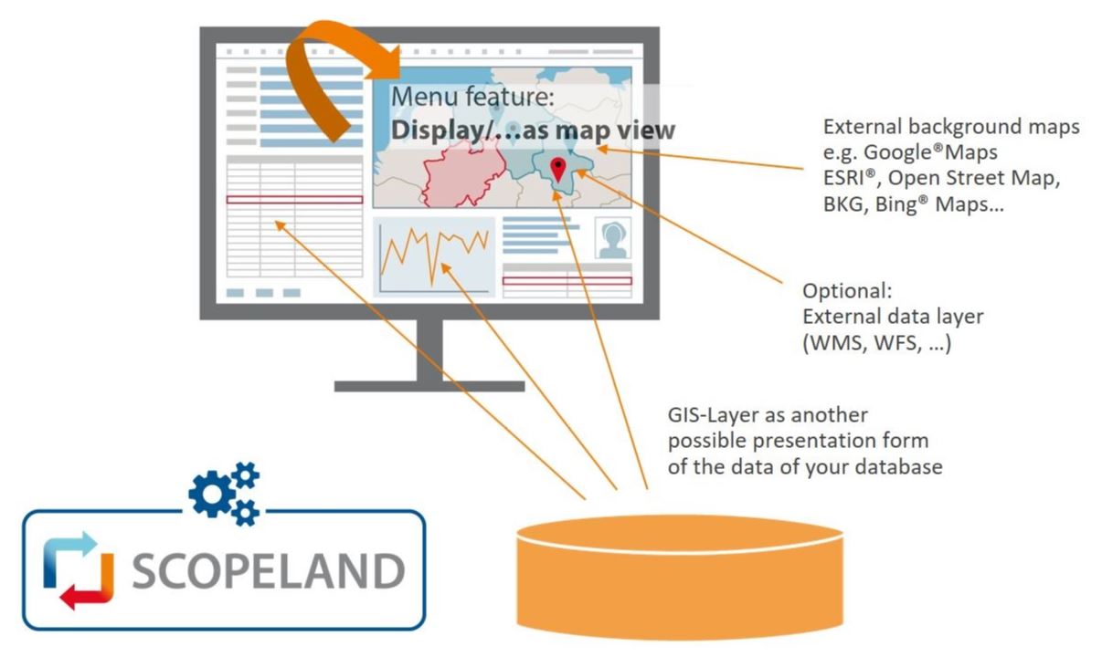
GIS objects can be points, lines and polygons (or multi-polygons), displayed in active and passive layers. Active layers are layers that the user can click, select and, if necessary, edit, and that are automatically and consistently synchronized with the attribute data section of the application in the respective ‘active’ object's display. Passive layers, on the other hand, are shown on the map as if they were part of the rendered background map. The layers are preconfigured by the application developer but can also be rearranged as required and switched on or off by the end user.
The layers can be optionally fed with database data or data from the outside (files in usual GIS formats or Web services). Everything is then converted internally between the various projections (geographical, UTM, Gauss Krueger) in an automatic and constant manner. This means that all data can be freely combined – any time and anywhere – even if it originates from different reference systems.
The user interface also features many generally available, interactive functions for exporting and importing geodata, drawing functions, and many more.
The system is rounded off by a range of standard server functions for intersections and other geo functions, as well as Web service integrations for geo-positioning and other external services. Provided the underlying spatial database functions exist, these can also be accessed.
The GIS object data can be stored in a spatial database or in a simple database (with some functional restrictions). Apart from this, geodata is handled in the same way that ‘normal’ database data is handled.
Our ‘Embedded GIS’ concept also allows documents to be generated with embedded map data, whether for the purpose of GIS reporting or for other printed output.
Read on